
Size of this preview: 800 × 596 pixels. Other resolutions: 320 × 238 pixels | 640 × 476 pixels | 908 × 676 pixels.
Original file (908 × 676 pixels, file size: 698 KB, MIME type: image/jpeg)
Summary
| Description |
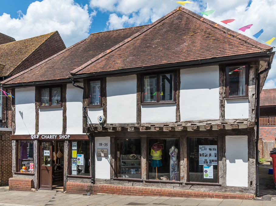
English: The oldest building in Leatherhead, dating from the 14th century as an open hall house. Grade II listed.
|
|
| Date | ||
| Source | From geograph.org.uk | |
| Author | Ian Capper | |
| Permission (Reusing this file) |
Creative Commons Attribution Share-alike license 2.0 | |
| Attribution (required by the license) | Ian Capper / 33 - 35 High Street / | |
| Camera location | | View this and other nearby images on: OpenStreetMap |
|---|
.jpg¶ms=051.295333_N_-000.327979_E_globe:Earth_type:camera_source:geograph-osgb36(TQ1667556461)_heading:315.00&language=en)
| Object location | | View this and other nearby images on: OpenStreetMap |
|---|
.jpg¶ms=051.295400_N_-000.328050_E_globe:Earth_class:object_type:object_source:geograph-osgb36(TQ1667056468)_heading:315.00&language=en)
Licensing

|
This image was taken from the Geograph project collection. See this photograph's page on the Geograph website for the photographer's contact details. The copyright on this image is owned by Ian Capper and is licensed for reuse under the Creative Commons Attribution-ShareAlike 2.0 license.
|
This file is licensed under the Creative Commons Attribution-Share Alike 2.0 Generic license.
Attribution: Ian Capper
- You are free:
- to share – to copy, distribute and transmit the work
- to remix – to adapt the work
- Under the following conditions:
- attribution – You must give appropriate credit, provide a link to the license, and indicate if changes were made. You may do so in any reasonable manner, but not in any way that suggests the licensor endorses you or your use.
- share alike – If you remix, transform, or build upon the material, you must distribute your contributions under the same or compatible license as the original.
File history
Click on a date/time to view the file as it appeared at that time.
| Date/Time | Thumbnail | Dimensions | User | Comment | |
|---|---|---|---|---|---|
| current | 11:12, 30 November 2021 | | 908 × 676 (698 KB) | Mertbiol | cropped |
| 11:08, 30 November 2021 |  | 1,024 × 676 (744 KB) | Mertbiol | Uploaded a work by [https://www.geograph.org.uk/profile/16999 Ian Capper] from From [https://www.geograph.org.uk/photo/6323226 geograph.org.uk] with UploadWizard |
File usage
The following pages on the English Wikipedia use this file (pages on other projects are not listed):
Global file usage
The following other wikis use this file:
- Usage on www.wikidata.org
.jpg)