

Size of this PNG preview of this SVG file: 606 × 600 pixels. Other resolutions: 243 × 240 pixels | 485 × 480 pixels | 776 × 768 pixels | 1,035 × 1,024 pixels | 2,070 × 2,048 pixels | 1,319 × 1,305 pixels.
Original file (SVG file, nominally 1,319 × 1,305 pixels, file size: 179 KB)
| Description |
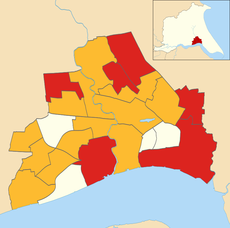
Map of Kingston upon Hull, East Riding of Yorkshire, England with electoral wards showing the 2007 local election results. Colours: Labour
Liberal Democrat
Uncontested
Geographic limits:
|
| Date | |
| Source | File:Kingston upon Hull UK ward map 2010 (blank).svg |
| Author |
|
| Permission (Reusing this file) |
This file is licensed under the Creative Commons Attribution-Share Alike 3.0 Unported license.
|
.svg)
File history
Click on a date/time to view the file as it appeared at that time.
| Date/Time | Thumbnail | Dimensions | User | Comment | |
|---|---|---|---|---|---|
| current | 13:25, 24 November 2011 | | 1,319 × 1,305 (179 KB) | Keith D | {{Information |Description=Map of Kingston upon Hull, East Riding of Yorkshire, England with electoral wards showing the 2007 local election results. Colours: {{legend|#dc241f|Labour}} {{legend| |
File usage
The following pages on the English Wikipedia use this file (pages on other projects are not listed):
Global file usage
The following other wikis use this file:
- Usage on www.wikidata.org