

Size of this preview: 450 × 600 pixels. Other resolutions: 180 × 240 pixels | 480 × 640 pixels.
Original file (480 × 640 pixels, file size: 304 KB, MIME type: image/jpeg)
| Description |
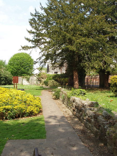
English: This wall was probably built between 1307 and 1346 when the abbey was substantially rebuilt. It separated the religious and domestic area of the abbey from its precinct of industrial and agricultural areas. The abbey was demolished following Henry VIII's dissolution of the monasteries. The wall has been restored recently, and a garden laid out around it. |
| Date | GMT |
| Source | From geograph.co.uk |
| Author | David Hawgood |
| Permission (Reusing this file) |
Creative Commons Attribution Share-alike license 2.0 |
| Attribution (required by the license) | David Hawgood / Ruined wall of Chertsey Abbey / |
| Camera location | | View this and other nearby images on: OpenStreetMap |
|---|
.jpg¶ms=051.393362_N_-000.502285_E_globe:Earth_type:camera__&language=en)

|
This image was taken from the Geograph project collection. See this photograph's page on the Geograph website for the photographer's contact details. The copyright on this image is owned by David Hawgood and is licensed for reuse under the Creative Commons Attribution-ShareAlike 2.0 license.
|
This file is licensed under the Creative Commons Attribution-Share Alike 2.0 Generic license.
Attribution: David Hawgood
- You are free:
- to share – to copy, distribute and transmit the work
- to remix – to adapt the work
- Under the following conditions:
- attribution – You must give appropriate credit, provide a link to the license, and indicate if changes were made. You may do so in any reasonable manner, but not in any way that suggests the licensor endorses you or your use.
- share alike – If you remix, transform, or build upon the material, you must distribute your contributions under the same or compatible license as the original.
File history
Click on a date/time to view the file as it appeared at that time.
| Date/Time | Thumbnail | Dimensions | User | Comment | |
|---|---|---|---|---|---|
| current | 23:19, 10 March 2009 | | 480 × 640 (304 KB) | Sarkana | {{Information |Description=This wall was probably built between 1307 and 1346 when the abbey was substantially rebuilt. It separated the religious and domestic area of the abbey from its precinct of industrial and agricultural areas. The abbey was demolis |
File usage
The following pages on the English Wikipedia use this file (pages on other projects are not listed):
Global file usage
The following other wikis use this file:
- Usage on de.wikipedia.org
- Usage on en.wikivoyage.org
- Usage on eo.wikipedia.org
- Usage on fr.wikipedia.org
- Usage on la.wikipedia.org
- Usage on sv.wikipedia.org
- Usage on www.wikidata.org
.jpg)