

Size of this preview: 556 × 600 pixels. Other resolutions: 223 × 240 pixels | 445 × 480 pixels | 712 × 768 pixels | 950 × 1,024 pixels | 2,096 × 2,260 pixels.
Original file (2,096 × 2,260 pixels, file size: 1.25 MB, MIME type: image/jpeg)
Summary
| Description |
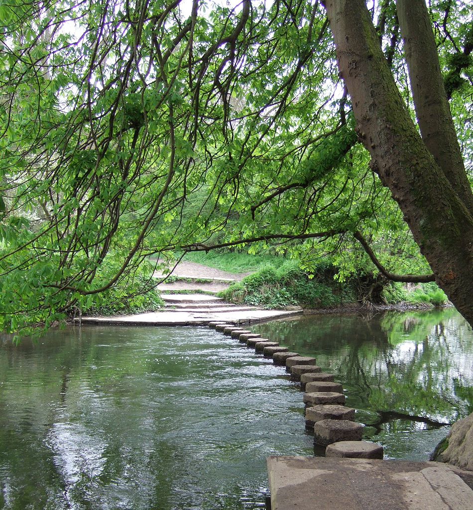
English: The Stepping Stones Crossing on the River Mole that is part of the North Downs Way |
| Date | |
| Source |
This file was derived from: The Stepping Stones - geograph.org.uk - 158891.jpg |
| Author | Martyn Davies |
| Camera location | | View this and other nearby images on: OpenStreetMap |
|---|
Licensing
This file is licensed under the Creative Commons Attribution-Share Alike 2.0 Generic license.
Attribution: Martyn Davies
- You are free:
- to share – to copy, distribute and transmit the work
- to remix – to adapt the work
- Under the following conditions:
- attribution – You must give appropriate credit, provide a link to the license, and indicate if changes were made. You may do so in any reasonable manner, but not in any way that suggests the licensor endorses you or your use.
- share alike – If you remix, transform, or build upon the material, you must distribute your contributions under the same or compatible license as the original.
File history
Click on a date/time to view the file as it appeared at that time.
| Date/Time | Thumbnail | Dimensions | User | Comment | |
|---|---|---|---|---|---|
| current | 22:36, 13 September 2010 | | 2,096 × 2,260 (1.25 MB) | RHaworth | higher res |
| 19:17, 9 February 2008 |  | 474 × 505 (342 KB) | Mertbiol | {{Information {{Information |Description= The North Downs Way crosses the River Mole via stepping stones at the foot of Box Hill in Surrey. |Source=http://www.geograph.org.uk |Date=Wednesday 26th April 2006 |Location=River Mole, Box Hill, Dorking, Surrey |
File usage
The following pages on the English Wikipedia use this file (pages on other projects are not listed):
Global file usage
The following other wikis use this file:
- Usage on ca.wikipedia.org
- Usage on eo.wikipedia.org
- Usage on fa.wikipedia.org
- Usage on fr.wikipedia.org
- Usage on he.wikipedia.org
- Usage on ja.wikipedia.org
- Usage on nn.wikipedia.org
- Usage on no.wikipedia.org