
Size of this preview: 424 × 599 pixels. Other resolutions: 170 × 240 pixels | 453 × 640 pixels.
Original file (453 × 640 pixels, file size: 117 KB, MIME type: image/jpeg)
Summary
| Description |
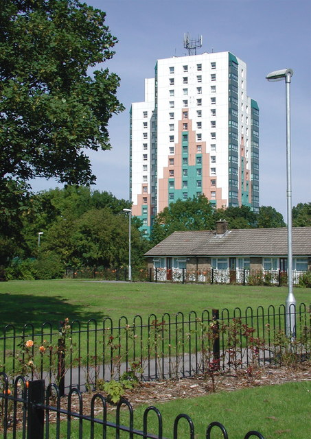
English: Sutton Ings, Hull. Looking north-northwest towards the Bayswater Court flats from the terraced bungalows on Garrick Close. |
| Date | |
| Source | From geograph.org.uk |
| Author | Paul Glazzard |
| Permission (Reusing this file) |
Creative Commons Attribution Share-alike license 2.0 |
| Attribution (required by the license) | Paul Glazzard / Sutton Ings, Hull / |
| Camera location | | View this and other nearby images on: OpenStreetMap |
|---|
_heading:337.00&language=en)
| Object location | | View this and other nearby images on: OpenStreetMap |
|---|
_heading:337.00&language=en)
Licensing

|
This image was taken from the Geograph project collection. See this photograph's page on the Geograph website for the photographer's contact details. The copyright on this image is owned by Paul Glazzard and is licensed for reuse under the Creative Commons Attribution-ShareAlike 2.0 license.
|
This file is licensed under the Creative Commons Attribution-Share Alike 2.0 Generic license.
Attribution: Paul Glazzard
- You are free:
- to share – to copy, distribute and transmit the work
- to remix – to adapt the work
- Under the following conditions:
- attribution – You must give appropriate credit, provide a link to the license, and indicate if changes were made. You may do so in any reasonable manner, but not in any way that suggests the licensor endorses you or your use.
- share alike – If you remix, transform, or build upon the material, you must distribute your contributions under the same or compatible license as the original.
File history
Click on a date/time to view the file as it appeared at that time.
| Date/Time | Thumbnail | Dimensions | User | Comment | |
|---|---|---|---|---|---|
| current | 21:13, 5 February 2011 | | 453 × 640 (117 KB) | GeographBot | == {{int:filedesc}} == {{Information |description={{en|1=Sutton Ings, Hull Looking north-northwest towards the Bayswater Court flats from the terraced bungalows on Garrick Close.}} |date=2007-08-23 |source=From [http://www.geograph.org.uk/photo/538135 geo |
File usage
The following pages on the English Wikipedia use this file (pages on other projects are not listed):
Global file usage
The following other wikis use this file:
- Usage on pl.wikipedia.org
- Usage on www.wikidata.org