

Size of this preview: 503 × 599 pixels. Other resolutions: 201 × 240 pixels | 403 × 480 pixels | 682 × 812 pixels.
Original file (682 × 812 pixels, file size: 235 KB, MIME type: image/png)
Summary
| Description |
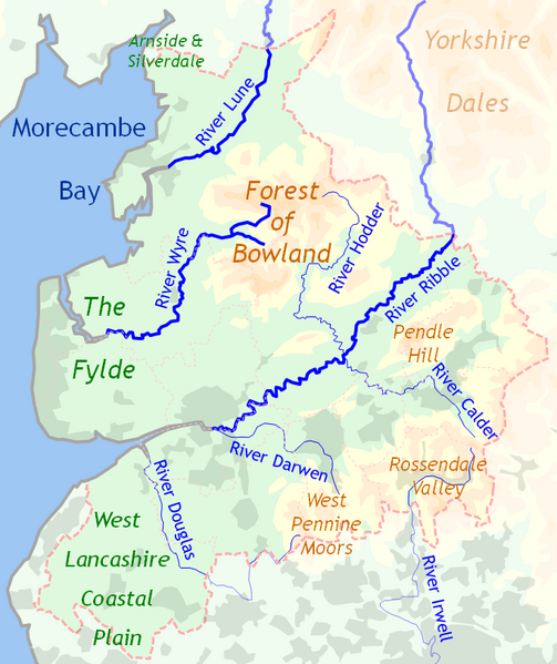
English: Topography of Lancashire, England |
| Date | |
| Source | Own work |
| Author | Dr Greg |
Licensing
| I, the copyright holder of this work, release this work into the public domain. This applies worldwide. In some countries this may not be legally possible; if so: I grant anyone the right to use this work for any purpose, without any conditions, unless such conditions are required by law. |
File history
Click on a date/time to view the file as it appeared at that time.
| Date/Time | Thumbnail | Dimensions | User | Comment | |
|---|---|---|---|---|---|
| current | 21:58, 24 September 2010 | | 682 × 812 (235 KB) | Dr Greg | {{Information |Description={{en|1=Topography of en:Lancashire, England}} |Source={{own}} |Author=Dr Greg |Date=2010-09-24 |Permission= |other_versions= }} Category:Maps of Lancashire [[Category:Maps of rivers in the United King |
File usage
The following pages on the English Wikipedia use this file (pages on other projects are not listed):
Global file usage
The following other wikis use this file:
- Usage on af.wikipedia.org
- Usage on ca.wikipedia.org
- Usage on it.wikipedia.org
- Usage on lt.wikipedia.org
- Usage on pt.wikipedia.org