| Milbourne Lodge School | |
|---|---|
| Address | |
 | |
Arbrook Lane , , KT10 9EG | |
| Information | |
| Type | Pre-prep & prep school |
| Established | 1912 |
| Headmaster | Judy Waite |
| Gender | Coeducational |
| Age | 4 to 13 |
| Website | www |
Milbourne Lodge School is a co-educational pre-prep and preparatory school for children aged four to thirteen.
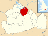
Located in Esher, Surrey, the school is housed in a Victorian mansion situated on 8.5 acres (3.4 ha) of Surrey countryside.
History
Milbourne Lodge was founded in 1912 by Harvey Wyatt, father of the politician Woodrow Wyatt,[1] who established the school in Arbrook Lane, Surrey. The school is situated on its original site, with the preparatory year groups occupying the original school building and the pre-preparatory year groups taught in what was previously the Headmaster's house.
In 1948 the school was bought by Norman Hale who was Headmaster for fifty-one years.[2][dead link][3]
In 2007 Milbourne Lodge became part of the Cognita group. The present head is Judy Waite.
In 2012, the school was found to have "improperly expelled a brother and sister after their parents criticised the parents' association's handling of finances".[4] Judge Robert Reid added that "'I am surprised that an apparently 100-year-old school has got such a shambles by way of a parents' association'".[4]
Notable staff
- Godfrey Sampson, composer and organist[5]
References
- ^ Wyatt, W.; Curtis, S. (1998). The Journals of Woodrow Wyatt. Macmillan. ISBN 978-0-333-74166-5. Retrieved 19 February 2024.
- ^ "Norman Hale: Milbourne Lodge Preparatory School (obituary)". The Times. 22 October 2008.
- ^ Brendon, Vyvyen (12 December 2009). Prep School Children: A Class Apart Over Two Centuries. A&C Black. ISBN 978-1-84706-287-1. Retrieved 19 February 2024.
- ^ a b Boffey, Daniel (28 October 2012). "Expulsion row hits ex-Ofsted chief Sir Chris Woodhead's schools empire". The Guardian. Retrieved 19 February 2024.
- ^ Whittle, D. (2017). Bruce Montgomery/Edmund Crispin: A Life in Music and Books. Taylor & Francis. p. 11. ISBN 978-1-351-57298-9. Retrieved 19 February 2024.
External links
- Official website
- "Norman Hale (obituary)". The Daily Telegraph. London. 20 October 2008.
51°21′55.31″N 0°21′59.54″W / 51.3653639°N 0.3665389°W

